Saturday, June 23, 2007

MT east to VT (in between: ADK!)


MARCY DAM, JUNE 2007

This post will need to be shorter than it should be due to time constraints resulting from sheer laziness. Anyways, here goes: I finished up field camp on June 11, had a cigar and a few beers at some bar in dillon with the rest of the crew, and then proceeded north to Missoula where I was able to find an apartment for the fall prior to flying back to Albany on June 16. Sweet.

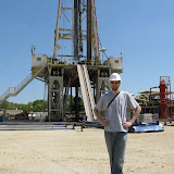
After a day or two of vegging out at home I headed north for the Adirondack high peaks with my high school friend Tom and his friend Mike from college. Tom and I have been hiking together since his mom was our cub scout leader-- it's been over a decade and lots of education and growing up and all of that crap, but we still like it! Here we are at Marcy Dam on June 18:


The hike went as follows: we parked at the ADK lodge and proceeded south on the trail to Marcy Dam where we camped monday night. In the morning we were woken up by the (loud) birds so we stashed our stuff under a lean-to and hit the trail early, hiking south through Avalanche Pass and eventually to beautiful Avalanche Lake -- one of the prettyest spots in the 'dacks that I've seen. Our attemts at photogrophy basically fail to do justice to the morning light playing on the water and the walls:


VIEW NORTH OVER AVALANCHE LAKE

The trail continues south around the lake on its western side. The sheer cliffs dive straight into the water at some places so the trail is on wooden planks bolted directlyi into the rock with nothing under them. Don't drop your sunglasses here, but it's a cool spot. Once you get to the south end of the lake you double back on the east side and bushwhack north through the woods for a ways until you reach a spot where boulders seem to spill out of the mountain on your right-hand site: the mouth of the dyke. Hang a right and start climbing: from here the route goes up steeply all the way to the summit of Mt. Colden and includes clambering up large boulders and rock faces followed by a slightly precarious walk up the steeply sloping slab that forms Colden's northwest slope.
After summiting Colden, we visited Indian Falls on the Way to Tabletop Mountain, which has views which can be optimistically described as very underwhelming. We hit it because it's one of the 46 peaks above 4,000 feet in the Adirondacks and it's cool if you can do them all. After Tabletop the weather started turning sour so we opted not to summit Phelps even though there was plenty of light left and we walked right bast the trail up it. We reached the lean-to at Marcy Dam just before the sky opened up poured. Lightning struck just across the pond from us and the thunder made quite a racket. After the hiking, i fell asleep in the lean-to despite the storm. As soon as it cleared we gathered our gear and rolled out towards the cars at the ADK lodge but were not fast enough: another storm broke while we were about a quarter of a mile out from the vehicles and we were completely -- and i do mean absolutely completely -- soaked through by the time we got there. Well, crap happens, you know? Anyways the ride home when fine and at the end of the day, a good time was had by all.

Since then I've been preparing for my upcoming trip to Vermont, where I will hike the Long Trail from Massachussets to Canada. This will be 270 miles. We (myself and Tom Jones, as opposed to Tom ligon who I was in the Adirondacks with...) decided to take it easy and stop to see some friends in Burlington. We will be in vermont for about a month. Preparations include the purchase and organization of gear and food, contacting folks to set up supply drops and whatnot, and my personal pet project of building an alcohol-burning stove out of Red Bull cans. The think is tiny and it rocks. We leave tomorrow.

I will update this post with more photos and links to interesting things upon my return from VT, as well as of course creating a new post regarding that trip.

Wish me luck (luck = good weather, no bears, and not running out of food).


Sunday, June 10, 2007

Mining History


Well, I'm down to the last day of field camp. One to go. And during this day I'll need to fill in a couple of holes in the map I've cobbed together of the Badger Pass area, to the west of Dillon. Badger Pass is located right between two historic montana mining districts: a few miles north is the Ermont district, and a few miles south is the Bannack district. Both were the sites of significant gold mining activity in the late nineteenth and earty twentieth centuries. The deposits mined included gravels, which were run through a waterworks or panned to remove gold pieces, and also ores. The geologic context is that Mississippian carbonate rocks have been thrust-faulted over Cretaceous intrusive and volcanic rocks in the area, with the fault plane running just beneath the surface in many places. Later in the Cretaceous, and igneous intrusion showed up on the scene, causing mineralized fluids to move around in the rocks. Among other things, these fluids contained ions of precious metals. The fluids would commonly follow the weak zone of the previous fault plane, and contact with the carbonates would alter their pH, causing the ions to come out of solution and form ore deposits, which were presumably subsequently mostly dug up by crazy old-timey Yosemite Sam type guys.


Walking in the field, one is confronted with constant reminders of the area's history (see link to right for photos): it's almost impossible to find a spot where you can't see prospect pits, tailing piles, or a dilapidated log building of one sort or another. And once in a while you chance upon a mine shaft: a gaping hole in the earth going straight down into blackness. Some of the shafts are covered surrounded by barbed wire fences, while others are coverd by a big steel grate that you can walk out on, perching yourself over the darkness. Looking down it's very hard not to feel a little spooked. If you yell down the shaft there is no echo, and if you drop a pebble through the grate, you don't hear it hit anything until after you are wondering if you might have missed the sound. We were also able to visit the ghost town of Bannack, first capital of Montana Territory. Bannack was a typical mining boom town -- two years after gold was struck near Grasshopper creek, a town of 3 to 5 thousand people existed where there had previously been nothing. The population of Bannack is back down to zero lately, and the ghost town has been made a state park and national historic site. The State of Montana maintains a web resource on abandoned mines and you can check out the history of Bannack here.


In addition to cool old buildings and stuff, the local lore is also quite interesting: Legend has it that gold shipments from Bannack were not making it to their destination (Virginia City, to the East). They were all being hijacked and no survivers were left to identify the thieves. Understandably, the businessmen of Bannack were concerned. So they formed a masonic group and began to search for answers. The theory they developed was that the sherrif was involved in a criminal gang which had a mole in the telegraph office in Virginia City and so was able to learn when the shipments were coming and ambush the caravans. The businessmen took justice into their own hands and formed a vigilante band which proceeded to hunt down accused gang members all over Montana. It's said that once they caught a guy they'd stand him on the stool and put the noose around his neck and ask him for the names of three others involved in the gang. Fearing for his life, he'd give them names. Then they'd kick out the stool anyways and go look for the guys he'd ratted out. Eventually the shipments were able to get through and things calmed down a bit. Case closed, right? Maybe. The stolen gold was never found: either the looters were able to sell it, it's still hidden someplace in the hills (we've been looking: no luck so far), or else some other funny business was afoot. Some people think that the sherrif was never involved at all, and that the vigilante businessmen had been pocketing the gold under the table all along. Blaming the sherrif would be convenient because it would call into question any accusations he might make of them, and stringing him up would simplify the cover-up operation by removing the detective and providing a scapegoat. The vigilantes all became powerful political families in the Territory and eventually the state, and needless to say the case has never been re-opened. So I guess we'll have to hike around in these hills bearing that uncertainty, but certainly glad that justice has become at least slightly more organized and armed highway robbery a little less common over the past hundred years or so.

Wednesday, June 6, 2007

Ash Flows and Hot Springs

The past couple days have been good. After four days of mapping in the beautiful Clark Canyon Reservoir area (follow this link for some photos), we handed our maps in on monday night before heading to Anderson Ranch on Tuesday.


We hiked around and Professor Jim showed us some remarkable ash deposits. It was relaxing to just be able to listen out of curiousity and not have a grade riding on it. And then today we drove to Jackson, MT where there is a hot springs that you can soak in.


It was also relaxing, because, well, it's easy to relax when you are sitting in a hot springs and drinking a beer with friends, right?

It's notable that the ash flows and the hot springs are both evidence of how volcanically active southwest Montana really is: The ash deposits are fluvially focused flows derived from an ash fall. According to Jim, what happened is that about ten million years back or so volcanic activity associated with the geologic hot spot currently located beneath Yellowstone park shot a column of hot ash high into the atmosphere. Upon cooling, the column collapsed on itself and spread out over the surrounding area, blanketing everything in up to several feet of the stuff. Rain washed the unconsolidated sediment off the hills and it piled up in river valleys to many times its original thickness (the deposits we saw were over 100 feet thick). These deposits consolidated over time into weak rock called tephra, which is how we find them. After visiting the ash, we hiked to the top of a ridge and got some pretty good views of the valley despite constantly changing weather.


(More photos of the Anderson Ranch area are up on my picasa page)

By the time we got back to Dillon it was pouring sheets of rain -- the first rain of much substance since my arrival almost a month ago. It will blow the fishing out pretty badly for a while. A relaxed evening and morning in the dorms and we were able to muster ourselves to get in the car and drive the hour to Jackson, MT.


Jackson is at just under 6500 feet and it was snowing pretty well when we got there. (This after two days ago when it was 85, sunny, and dry). And to our dismay, the hot springs pool was empty (*gasp!*). Fortunately, it was only temporarily empty for cleaning, which apparently happens on wednesdays. The waters of the Jackson springs are geothermally heated underground by the proximity of molten rock someplace down there. The water comes to the surface and gets pumped around town to people's radiators, heating the buildings at very low cost. Then it comes out of a pipe at the top end of the pool at the lodge, still pretty scalding hot, and helps to relax locals and passers-through. Louis and Clark came through on their trip. One anectode is that since their thermometer was busted by then, they told how hot the water was by how hot they could stand to sit in it. Apparently the journal claims one of them got nineteen minutes, but reports from folks who have read the actual journals suggest this is inaccurate and the springs were much hotter than that (see comment below). Well anyways, it takes a while to fill the pool up so we took advantage of the lodge's collasal fireplace and looked around at the impressive array of dead things' heads on the walls while we waited. Once it was full enough to walk down to the deep end and lie down and be covered, we went for it. It was, of course, still snowing, which made for a lot of steam coming off the water and the nifty feeling of being really warm while cold wind nips at your face. The water of course has traveled a ways from the source by this point and it cools off a little bit in the pool so we were able to stay in a couple of hours before scrambling through the snow and into the lodge to get ready to head back to Dillon (incidentally, I lost my second watch of field camp in the scramble. I think maybe I quit buying watches for a while...)

NOTES:

* One mapping project left before heading to Missoula with the mission of finding an apartment in 3 days. Hoping to find a place cheap enough I can break even on my stipend. Slightly anxious about that...

* Congrats to Carolyn for graduating!

* Preparations continue for the Long Trail hike. How exciting!

* I am thinking about choosing classes for the fall, which brings up the question of what direction to take with my Masters degree and rouses the spectre of the potential for needing to figure out what to do with my life after the degree... oh, bother...